Ughtasar

Region
Shirak
Distance from Yerevan
131.4 km
Type
Mountain
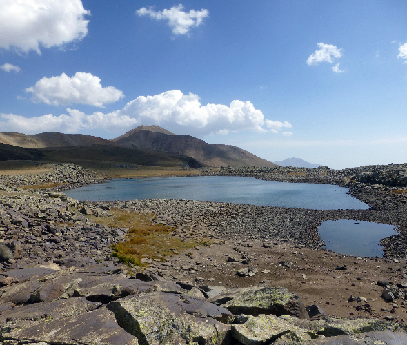
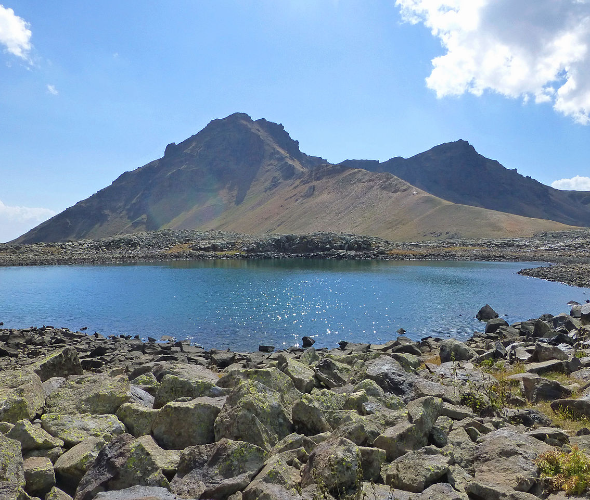
Ughtasar is a mountain massif located in the central part of the Syunik Plateau, about 30 kilometers from the town of Sisian, at elevations between 3,000 and 3,300 meters above sea level. Its name—Ughtasar, meaning “Camel Mountain”—derives from its camel hump-like shape, situated between the Sev (Black) and Al (Red) Lakes. According to local ancient beliefs, pilgrims once made long and arduous journeys to this site to purify themselves and make offerings, often depicting their sacrifices or prayers on stone. Over 2,000 petroglyphs (rock carvings) have been discovered on the slopes of Ughtasar, near ancient volcanic craters, lakes, and ravines. These carvings are among the oldest archaeological monuments of Syunik, typically engraved on flat surfaces of copper-colored or black volcanic stones, with grooves measuring 2–6 mm in depth and 2–20 mm in width. The petroglyphs depict a wide range of scenes—from hunting episodes to natural landscapes and cosmological concepts, including strong evidence of sun worship. There are images of deer, predators, and symbolic figures that reflect the environmental awareness and spiritual life of the region's ancient inhabitants.

Interesting
facts about Ughtasar


Facts
Weather in Shirak
The high season in Armenia lasts for a long time due to the pleasant climate conditions. Warm days in Armenia start in March and last until late autumn; winter is usually snowless and not long. The high precipitation season is variable. The tourist season for mount Ukhtasar depends on the weather conditions.
Sights
near Ughtasar

Baghaberd Fortress
58 km

Vahanavank monastery
65 km
Halidzor Fortress
68 km

Devil’s Bridge
70 km